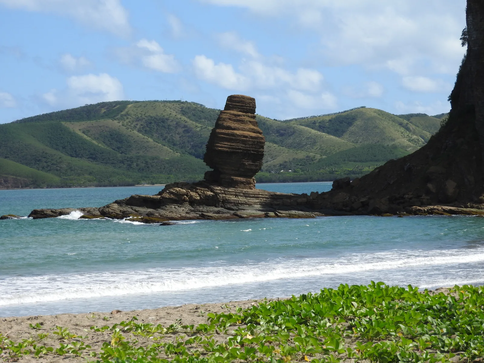
What is Roche Percée?
Roche Percée is an exposed coastal and surf area beside the Néra river mouth and the Bonhomme de Bourail rock formation. It is also the starting area for the Three Bays Trail.
Why go?
Come for coastal scenery, photography, walking, surf context and the Bonhomme landmark. This is the visually dramatic counterpart to the calmer Poé lagoon.
It suits travellers who want a scenic morning or a coastal walk more than a conventional swimming-beach day.
Swimming and coastal safety
Official tourism wording has varied between forbidden and discouraged swimming, while consistently warning about dangerous conditions. This guide does not give clearance to swim. Follow current signs and local instructions.
Old viewpoint access around the Bonhomme has also been affected by safety closures. Use current marked access rather than relying on an old route description.
Read the practical safety guidanceIs Roche Percée right for surfing?
Roche Percée is Bourail’s recognised surf coast, but that does not make it a beginner swimming beach. Shore and reef conditions change with swell and current. Experienced surfers should check the day’s access and local conditions before entering.
Nekwéta lists surfboard hire and boat transport to reef breaks or the Néra mouth when conditions suit. Those services are for a planned surf session, not a general recommendation to enter hazardous water. Confirm ability requirements, equipment, meeting point and the return plan directly.
Alternative: if surfing is not appropriate for your group or the conditions, use Roche Percée for the marked coast and viewpoints, or choose the calmer lagoon activities at Poé.
Check current Nekwéta servicesHow long should you allow?
Allow one to two hours for the immediate coast and viewpoints. Allow about half a day if you are walking the official 4 km Three Bays Trail, which is rated Medium and includes steep sections and falling-rock risk.
Plan the Three Bays TrailNearby places
Baie des Tortues and Baie des Amoureux sit along the Three Bays route. Poé and Déva are separate areas and should not be treated as the next stop on foot.
Use the one-day coastal outlineSources & updates
Source review: 4 October 2026. Access, services and conditions can change. Confirm current details before travelling.
Official coastal guideOfficial Nekwéta listingHow we research this guide